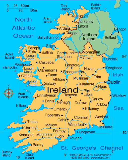
Ireland is an island Northwest of Europe, located between
latitudes 51º and 56ºN, and longitudes 11º and 5º W. The entire island is
roughly 52,457 miles (84,421 km). Together with Ireland’s neighboring
small islands and Great Britain it is a part of the British Isles. The highest
point in Ireland is at the Peak of Carrauntoohil Mountain sitting at an
elevation of 3,406 ft. Carrauntoohil is part of a set of coastal mountains in
the middle of Ireland. Four of Ireland's six peaks above 3,000 feet are found in
the MacGillycuddy Reeks in Kerry. The longest river, the River Shannon starts
in the Northwest region of the country and extends 240 miles in land to
Limerick City located in the Midwest.
The islands northern, southern, and western shores are located in the
Atlantic Ocean. Between Ireland's eastern shore and Great Britain lies the Irish
Sea. The eastern coastline has beaches backed by sand dunes and typically
feature very rocky headlands. The southern areas of Ireland have more
mountainous regions while the northern areas have small, tightly packed hills
with bog land in between.

No comments:
Post a Comment